Análise Modelos, Previsão e Alertas - Março 2009

vitamos

Super Célula
Registo
11 Dez 2007
Mensagens
5,481
Local
Estarreja
Alertas em vigor pelo Instituto de Meteorologia para diversos distritos devido ao vento forte e à ondulação forte na costa Algarvia:

alertas-1.jpg


www.meteo.pt


Mário Barros

Furacão
Registo
18 Nov 2006
Mensagens
12,603
Local
Maçores (Torre de Moncorvo) / Algueirão (Sintra)
Tempo: céu limpo em Portugal Continental; alerta amarelo no Algarve

O Algarve está hoje com aviso amarelo (o segundo numa escala de quatro), devido à previsão de vento fraco e por vezes forte nas terras altas da região Centro.

Segundo o Instituto de Meteorologia, em Portugal Continental, o céu vai estar pouco nublado ou limpo, temporariamente nublado no litoral a sul do Cabo Carvoeiro.

Para sexta-feira, o IM prevê uma pequena descida da temperatura máxima e a possibilidade de aguaceiros e trovoada na região Sul e litoral Centro.

TEMPERATURAS MÁXIMAS PREVISTAS:

Porto - 23ºC

Lisboa - 21ºC

Faro - 18ºC

Funchal - 21ºC

In:Lusa
 

thunderboy

Cumulonimbus
Registo
27 Nov 2008
Mensagens
2,030
Local
Alcanena/Aveiro


Storm Forecast
Valid: Fri 20 Mar 2009 06:00 to Sat 21 Mar 2009 06:00 UTC
Issued: Thu 19 Mar 2009 17:29
Forecaster: TUSCHY

SYNOPSIS

A temporarily retrograde moving upper trough over S-central Europe starts to cut off with a rapidly intensifying surface depression over Sicily, S-Italy and W-Ionian Sea. Strong ridging persists over W-Europe while an intense cold-core vortex opens the floodgates to another outbreak of very cold air, affecting extreme N/NE-Europe.

DISCUSSION

... Adriatic Sea, Tyrrhenian Sea and Ionian Sea ...

Cold upper low enters the central Mediterranean with widespread moderate instability release expected over the warm waters. The environment is supportive for scattered thunderstorms under the weakly sheared base of the trough with marginal hail/gusty winds. LL CAPE release is not impressive, but synoptic patterns is not unkown for spout reports, so we include the possibility of a few spout events, especially from Sicily NE-wards, where best timing/strongest convection will likely occur.

Another focus is the southward racing cold front, crossing Sicily during the late afternoon hours. Main concern arises as the front finally enters the Ionian Sea from the west ( ~ midnight ) and continues to shift eastwards. Better LL moisture ahead and placed under the left exit of a strong mid-level streak, thunderstorm coverage and intensity will be on the increase. Only the southern fringe of the line will see strongest deep-layer shear, also quite strong at lowest 3km (15-20m/s). We went with a level-1 to highlight the chance of a few severe wind gusts, isolated large hail events.

The immediate W-coast of Greece was included, too for the 03Z-06Z time-frame as the squalline approaches from the west. Directional shear at lowest levels increases markedly and it's not out of question that thunderstorms take profit of that environment, developing LL mesocyclones with a very isolated tornado risk. Hail could also locally reach 2cm with strong wind gusts possible.

Rapidly developing surface depression over S-Italy and attendant teight gradient augment the severe wind gust risk, but best downward transport of strongest impuls occurs in the dry/cold postfrontal airmass, where deep convection is unlikley. Hence this risk is not reflected on the map.

... Slovenia,Croatia and Hungary ...

A swath of marginal better LL moisture covers those areas as some moisture from the Black Sea depression advects SW-wards under very cold mid-levels (readings at 500hPa below -35°C). A diurnal dirven increase in convection is forecast and a few thunderstorms are possible although degree of electrification of expected convection is somewhat uncertain. However confidence is high enough for issuing a general thunderstorm area. Marginal hail and strong wind gusts are possible.

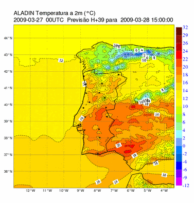
... Extreme S-Portugal ...

Past few GFS runs had persistent signals of roughly 500J/kg SBCAPE over extreme S-Portugal during the afternoon/early evening hours. Strong diabatic heating will push surface temperatures at or above 20°C and forecast sounding show a well mixed layer below ~ 800hPa. The attention turns to a weak mid-level negative temperature anomaly, associated with a SE-ward sliding upper low. Latest runs keep this feature with coldest mid-levels well offshore and at 700hPa a belt of marginal warmer temperatures runs from Portugal SE-wards. No forcing is present during peak heating. However geopotential heights decrease somewhat and we see some weak upper divergence so a very isolated and short lived thunderstorm can't be ruled out. 12Z run (GFS) and NOGAPS/GEM support that idea and a thunderstorm area may be needed, if new model/synop data confirm that.
 

thunderboy

Cumulonimbus
Registo
27 Nov 2008
Mensagens
2,030
Local
Alcanena/Aveiro


Storm Forecast
Valid: Sun 22 Mar 2009 06:00 to Mon 23 Mar 2009 06:00 UTC
Issued: Sun 22 Mar 2009 00:44
Forecaster: SCHLENCZEK

SYNOPSIS

An upper trough over the eastern Mediterranean is forecast to travel eastward during the period. Cold upper air in the wake of the trough will lead to some hundred J/kg CAPE over parts of Greece / SW Turkey and thunderstorms are expected to develop in the eastern Mediterranean region.

Further upstream, a low pressure system near Iceland moves southeastward. Between this feature and a large upper ridge west of Ireland, a strong 65 m/s upper jet streak stretches from southern Greenland towards central Europe. The upper trough of the low pressure system will affect southwestern Norway and Denmark / northern Germany in the evening / night hours. In the wake of the cold front, showers and weakly electrified thunderstorms may evolve. Lightning will be too sporadic for a highlighted thunderstorm area. In extreme southern Norway and northwestern Denmark, a strong gradient flow may lead to isolated severe non-convective gusts.


DISCUSSION

...SW Turkey...

A small region of SW Turkey will show quite good conditions for organized multicells and perhaps a few mesocyclones. Deep layer shear in order of 25 m/s and enhanced 10 - 15 m/s LLS are present and low LCL heights may allow an isolated tornado. A limiting factor will be the rather dry airmass (nearly all soundings in the vicinity of Izmir show a dry BL and therefore little or no CAPE). A categorical threat level is not introduced as convective initiation in the region with acceptable kinematic conditions is uncertain.

...E Mediterranean...

In the wake of the trough, showers and thunderstorms will develop in an environment with a few hundred J/kg of CAPE. Especially in the Aegean region, low level lapse rates reach values around 10 K/km in a region with weak vertical shear. This may result in a few waterspouts but overall threat will stay below the LVL1 threshold.

...W Iberia...

Some low-end instability is expected over western Portugal where an upper trough translates westward. Kinematic conditions are not favourable for organized storms (less than 15 m/s DLS, weak forcing) and showers / thunderstorms that may develop are probably non-severe.
 

AnDré

Moderação
Registo
22 Nov 2007
Mensagens
12,209
Local
Odivelas (140m) / Várzea da Serra (930m)
Estamos na recta final deste verão primaveril. Dentro em breve lá virá a nortada lembrar-nos que é em Março que estamos e não em Maio/Junho.

O IM fala na previsão descritiva em "descida acentuada da temperatura máxima" para o dia de amanhã.

Continente

Previsão para Sábado, 28 de Março de 2009


Períodos de céu muito nublado, tornando-se pouco nublado a
partir do fim da tarde.
Possibilidade de aguaceiros fracos.
Vento fraco a moderado (10 a 25 km/h) de noroeste, soprando
moderado a forte (30 a 50 km/h) e com rajadas até 70 km/h no
litoral oeste e nas terras altas.
Descida acentuada da temperatura máxima.
Pequena descida da temperatura mínima.

ESTADO DO MAR
Costa Ocidental: Ondas de noroeste com 4 a 5 m.
Temperatura da água do mar: 14/15ºC
Costa Sul: Ondas de sudoeste com 1 a 1,5 m.
Temperatura da água do mar: 16ºC

Comparação entre a previsão da Temperatura a 2m do ALADIN para o dia de hoje às 15h e o dia de amanhã às 15h.

41003_20090327_00_015.gif
41003_20090327_00_039.gif


No interior da Península a descida da temperatura máxima será ainda mais acentuada, até porque hoje ainda terão uma pequena subida da temperatura máxima face ao dia de ontem. Daí o trambolhão ser ainda maior.

Temperatura máxima prevista para hoje vs Variação relativamente ao dia anterior.

hojmax.gif
hjanomalia.gif


Temperatura máxima prevista para amanhã vs Variação relativamente ao dia de hoje.

tw2gp099.gif
anomamanh.gif
 

Mário Barros

Furacão
Registo
18 Nov 2006
Mensagens
12,603
Local
Maçores (Torre de Moncorvo) / Algueirão (Sintra)
Vento e frio prometem estragar fim-de-semana

O calor dos últimos dias promete fazer uma pausa pelo menos durante este fim-de-semana. Vento, chuva fraca e diminuição acentuada das temperaturas são as previsões do Instituto de Meteorologia.

O Instituto de Meteorologia (IM) está a prever um fim-de-semana desagradável, com uma diminuição das temperaturas, alguma chuva e vento.

À TSF, o meteorologista Pedro Reis Vieira adiantou as previsões para os próximos dias.

«Estávamos com temperaturas muito elevadas, até para a época do ano, e vamos ter no sábado uma descida acentuada da temperatura máxima. De qualquer forma, vai ser um fim-de-semana frio, até porque vai ser acompanhado de um vento forte de Norte, podendo chegar aos 50 Km/h, quer no Litoral, quer nas terras altas», adiantou.

«Talvez seja bom não arrumar os casacos durante o fim-de-semana, se bem que a partir de segunda-feira o tempo tende a melhorar», acrescentou.

In:TSF
 

Vince

Furacão
Registo
23 Jan 2007
Mensagens
10,624
Local
Braga
Hoje então temos a nortada que já se faz sentir, mas cujo pico será lá para as 18:00 de hoje:

Vento 10m Hoje

ventot.gif


A precipitação parece que andará sempre a rodear-nos, mas é provável que alguns aguaceiros consigam penetrar num ou noutro local.


Precipitação hoje e amanhã

prec.gif


Noutros modelos o cenário da precipitação é similar:

Precipitação HIRLAM/AEMET e ECMWF/IM
(até meia noite de Domingo)

hirlam.gif
ecm.gif


Temperatura 2m até Terça-feira

temp.gif
 

thunderboy

Cumulonimbus
Registo
27 Nov 2008
Mensagens
2,030
Local
Alcanena/Aveiro
Alertas para: Viana do Castelo, Braga, Porto, Aveiro, Coimbra, Leiria, Lisboa, Setúbal, Beja e Faro.


Alertas para: Vila Real, Viseu, Bragança, Guarda, Castelo Branco e Portalegre.


Santarém e Évora- não há alerta(verde).