ZCZC MIATCDAT1 ALL
TTAA00 KNHC DDHHMM
Potential Tropical Cyclone Sixteen Discussion Number 2
NWS National Hurricane Center Miami FL AL162019
400 PM CDT Thu Oct 17 2019
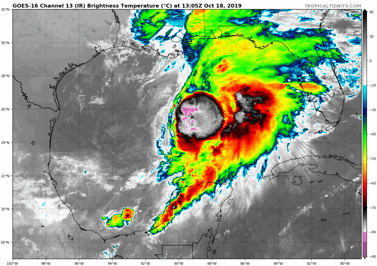
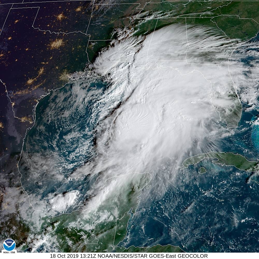
The complicated weather situation over the Gulf of Mexico described
in the previous advisory continues to evolve. Recent
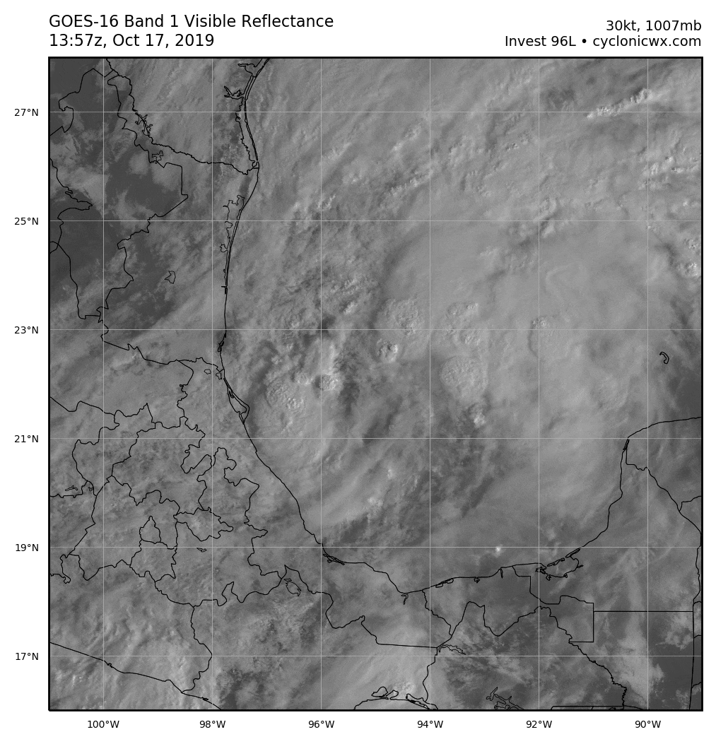
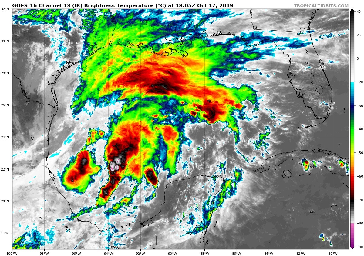
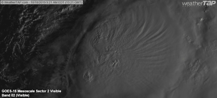
scatterometer data shows that the tropical disturbance in the
southwestern Gulf has a circulation elongated north-northeast to
south-southwest, with winds of 30-35 kt occurring in the
southwestern quadrant. However, the system currently has neither
sufficient convection or a well-enough defined center to be
designated a tropical or subtropical cyclone. The disturbance
remains in close proximity to a mid- to upper-level low moving
across southern Texas and northeastern Mexico and a frontal system
over the northern and northwestern Gulf. One change from the
previous global model guidance is the the ECMWF and GFS have backed
off of their forecasts of a separate baroclinic low to the north of
the disturbance. Instead, the global models are in reasonable
agreement that the disturbance, along with whatever vorticity
centers form along the front, will be part of a large low pressure
area that will affect portions of the northern Gulf coast and the
southeastern United States.
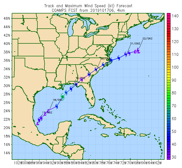
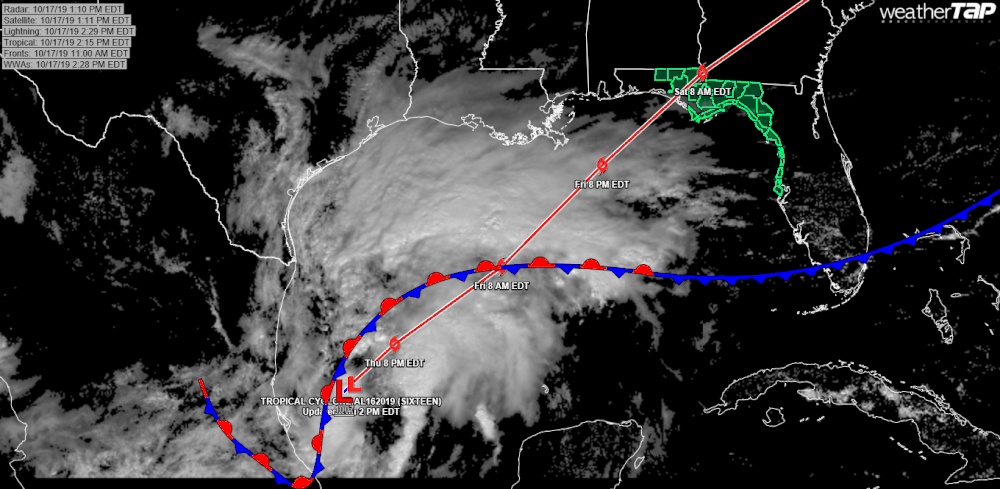
The initial motion of the disturbance is now 020/8. There is little
change in the forecast track philosophy, the track guidance, or the
NHC forecast track. The system should soon turn northeastward in
the southern portion of the mid-latitude westerlies, and the track
model guidance agrees on a continued northeastward motion through at
least 72 h. The forecast track, which is in best agreement with the
HCCA corrected consensus model, brings the system across the
southeastern United States between 36-72 h, and then has it moving
into the Atlantic east of the mid-Atlantic States.
Gradual strengthening is expected as strong upper-level divergence
caused by the trough partly prevails over strong vertical shear.
Based on this, the intensity forecast again calls for gradual
strengthening until landfall in agreement with the global model
forecasts. While it remains unlikely that the system will develop
into a classical tropical cyclone, the ECMWF and GFS models suggest
enough organized convection will develop before landfall to make the
system a tropical or subtropical cyclone. After landfall, the
cyclone is forecast to become fully extratropical and gradually
weaken.
Regardless of the exact evolution, portions of the northern coast of
the Gulf of Mexico will experience strong winds, locally heavy
rains, and storm surge Friday and Saturday. Similar impacts are
expected across portions of the Atlantic coast of the southeastern
United States Saturday and Sunday.
Key Messages:
1. There is a danger of life-threatening storm surge inundation of
up to 5 feet above ground level beginning Friday along the Florida
Gulf Coast from Indian Pass to Clearwater, where a Storm Surge
Warning is in effect. Residents in these areas should follow advice
given by local officials.
2. Tropical storm force winds are likely by Friday afternoon along
portions of the central and eastern Gulf Coast, where tropical storm
watches and warnings are in effect. Regardless of the exact track
and intensity of the system, these winds will cover a large area,
especially east of the center.
3. Isolated flash flooding is possible along the central and eastern
Gulf Coast, mainly Friday and Friday night. Since soils across the
southeast are dry, the risk of flash flooding will be confined to
the immediate coast where heavier rainfall is possible.
4. Wind and coastal flooding hazards along the U.S. East Coast will
be covered by non-tropical watches and warnings issued by local NWS
offices, since the system is expected to lose any tropical
characteristics after it moves inland along the Gulf Coast.
FORECAST POSITIONS AND MAX WINDS
INIT 17/2100Z 22.9N 95.2W 35 KT 40 MPH...POTENTIAL TROP CYCLONE
12H 18/0600Z 24.5N 92.9W 35 KT 40 MPH...TROPICAL STORM
24H 18/1800Z 26.9N 89.8W 40 KT 45 MPH
36H 19/0600Z 29.3N 86.9W 45 KT 50 MPH
48H 19/1800Z 31.4N 84.1W 40 KT 45 MPH...POST-TROP/EXTRATROP
72H 20/1800Z 35.6N 76.2W 40 KT 45 MPH...POST-TROP/EXTRATROP
96H 21/1800Z 37.5N 70.0W 35 KT 40 MPH...POST-TROP/EXTRATROP
120H 22/1800Z 38.5N 66.5W 30 KT 35 MPH...POST-TROP/EXTRATROP
$$
Forecaster Beven
NNNN