Furacão Michael
- Thread starter luismeteo3
- Data de início
-
O novo portal está no ar! Novos meteogramas, cartas, e mais. Mais informações neste tópico
Seguimento Meteorológico: Litoral Norte | Interior Norte e Centro | Litoral Centro | Sul | Açores e Madeira | Livre
Previsões: Curto e médio prazo: até 2 semanas | Longo prazo: mensal e sazonal (Regras e links úteis nos 1ºs posts)
Facebook | Avisos IPMA/Alertas ANEPC
You are using an out of date browser. It may not display this or other websites correctly.
You should upgrade or use an alternative browser.
You should upgrade or use an alternative browser.
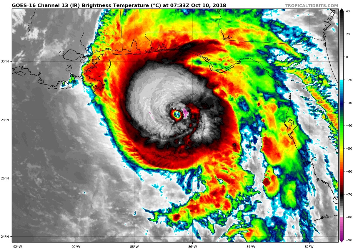

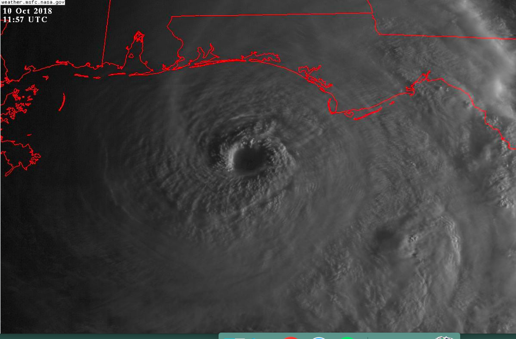
Reports from an Air Force Reserve Hurricane Hunter aircraft indicate
that maximum sustained winds have increased to near 140 mph (220
km/h) with higher gusts. Michael is an extremely dangerous category
4 hurricane on the Saffir-Simpson Hurricane Wind Scale. Some
additional strengthening is possible before landfall. After
landfall, Michael should weaken as it crosses the southeastern
United States.
NHC 5 AM EST Update: Up to 140 mph and down to 943 mbar at the new advisory. Good morning Panhandle, watch out.
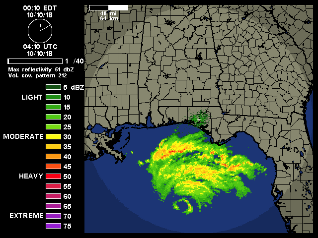
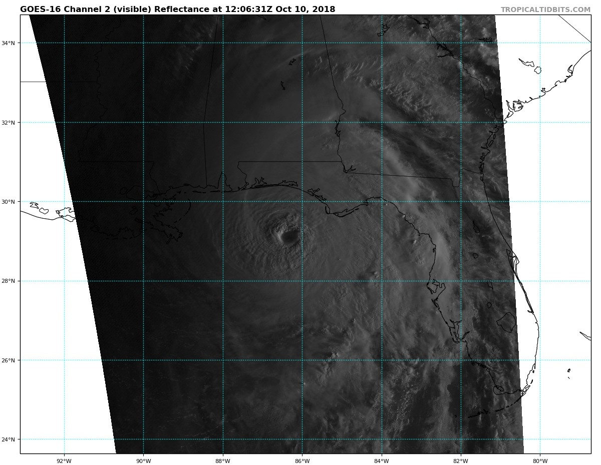
...5 AM CDT POSITION UPDATE... ...RAINBANDS OF MICHAEL SPREADING ACROSS THE FLORIDA PANHANDLE...
5:00 AM CDT Wed Oct 10
Location: 28.6°N 86.4°W
Moving: N at 13 mph
Min pressure: 937 mb
Max sustained: 140 mph
5:00 AM CDT Wed Oct 10
Location: 28.6°N 86.4°W
Moving: N at 13 mph
Min pressure: 937 mb
Max sustained: 140 mph
9am EST Update is out.
000
WTNT64 KNHC 101252
TCUAT4
Hurricane Michael Tropical Cyclone Update
NWS National Hurricane Center Miami FL AL142018
800 AM CDT Wed Oct 10 2018
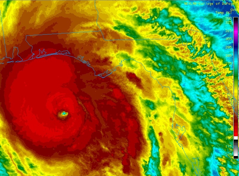
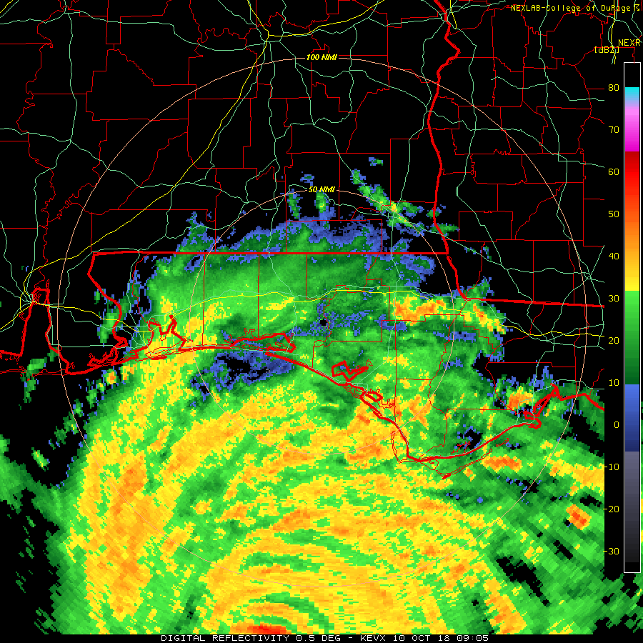
...8 AM CDT POSITION UPDATE...
...WATER LEVELS QUICKLY RISING AND WINDS INCREASING ALONG THE
FLORIDA PANHANDLE AS POTENTIALLY CATASTROPHIC MICHAEL APPROACHES...
A National Ocean Service station at Apalachicola recently reported
a sustained wind of 40 mph (65 km/h) and a wind gust of 53 mph (85
km/h).
SUMMARY OF 800 AM CDT...1300 UTC...INFORMATION
-----------------------------------------------
LOCATION...29.1N 86.2W
ABOUT 80 MI...130 KM SSW OF PANAMA CITY FLORIDA
ABOUT 85 MI...135 KM WSW OF APALACHICOLA FLORIDA
MAXIMUM SUSTAINED WINDS...145 MPH...230 KM/H
PRESENT MOVEMENT...N OR 10 DEGREES AT 13 MPH...20 KM/H
MINIMUM CENTRAL PRESSURE...933 MB...27.55 INCHES
$$
Forecaster Brennan
000
WTNT64 KNHC 101252
TCUAT4
Hurricane Michael Tropical Cyclone Update
NWS National Hurricane Center Miami FL AL142018
800 AM CDT Wed Oct 10 2018
...8 AM CDT POSITION UPDATE...
...WATER LEVELS QUICKLY RISING AND WINDS INCREASING ALONG THE
FLORIDA PANHANDLE AS POTENTIALLY CATASTROPHIC MICHAEL APPROACHES...
A National Ocean Service station at Apalachicola recently reported
a sustained wind of 40 mph (65 km/h) and a wind gust of 53 mph (85
km/h).
SUMMARY OF 800 AM CDT...1300 UTC...INFORMATION
-----------------------------------------------
LOCATION...29.1N 86.2W
ABOUT 80 MI...130 KM SSW OF PANAMA CITY FLORIDA
ABOUT 85 MI...135 KM WSW OF APALACHICOLA FLORIDA
MAXIMUM SUSTAINED WINDS...145 MPH...230 KM/H
PRESENT MOVEMENT...N OR 10 DEGREES AT 13 MPH...20 KM/H
MINIMUM CENTRAL PRESSURE...933 MB...27.55 INCHES
$$
Forecaster Brennan
Há quem não esteja mínimamente preocupado.. 
Partilhar: