Re: Seg.Esp. Chuva e Trovoada: Sistema depressionário «Dulce» - Setembro 2008
Parece que é hoje que isto animará.
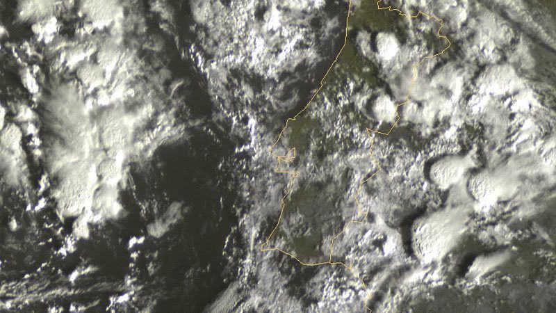
(c) http://www.sat24.com/
Parece que é hoje que isto animará.
(c) http://www.sat24.com/
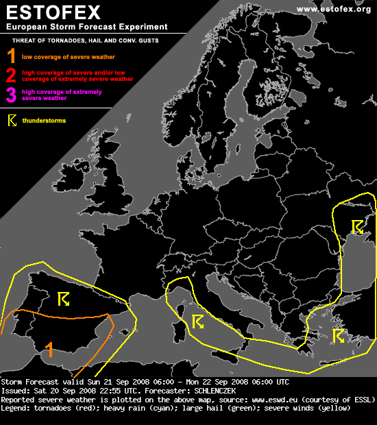
...S Iberia...
WAA at lower levels and diurnal heating will create some hundred J/kg of CAPE during the afternoon. GFS puts most of the instability both ahead of the upper trough and below the upper cold core whereas the latter is characterized by weak vertical shear. Between 15 and 30 m/s deep layer shear and locally augmented SRH3 will be in place in a small region near the upper jet streak between northern Morocco and the Balearic Islands. During the afternoon, a small upper vort max will overspread the region and some organized multicells / possibly a few supercells with large hail / damaging gusts may form. Some storms may persist for some hours over the same region which may lead to local flash floods.
Some spatial uncertainties with the low level moisture remain. An upgrade will follow if CIN is relatively small and LL moisture at least as high as forecast by GFS 12 UTC.
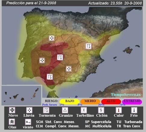
ANÁLISIS SINÓPTICO Y MESOSCALAR
Una DANA se aproxima lentamente por el Oeste Peninsular, con condiciones de inestabilidad muy favorables en la Península Ibérica entre el domingo 21 de septiembre y lunes día 22.
Habrá vientos marítimos en zonas como el Suroeste y Este peninsular, lo cual apoyará la posibilidad de precipitaciones localmente importantes, siendo más probables en puntos de la mitad Oeste debido a la cercanía de la DANA. Y especialmente en las vertientes orientadas al suroeste de esas zonas. Habráque vigilar especialmente si surge algún SMC que puede permanecer estático o tener un desplazamiento lento, lo cual daría grandes acumulaciones de lluvia.
Las lluvias seguras y tormentas probables se reactivarán al cruzar el sistema ibérico y llegar al Mediterráneo, especialmente en el sur de Cataluña y Castellón.

 .
.
 )
)
") )
)


