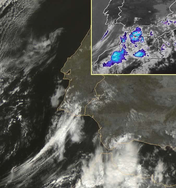
Abri este tópico especial, pois, a situação pode ser mesmo muito complicada no Sul.
Reparem nisto:

© estofex
Reparem nisto:

© estofex
Fonte: © estofexSYNOPSIS
Large trough remains over northern Atlantic. At its flank, a trough over south-eastern Europe starts to cut off over the Balkans, as high pressure builds over central Europe. A frontal boundary now present over the western Black Sea region will remain quasi-stationary and is expected to weak during the period. Over south-western Europe, a cut-off low situated west of the Iberian Peninsula will lead to severe thunderstorms over Spain.
DISCUSSION
Aegean to south-western Black Sea
A warm and relatively unstable air mass is present over western Black Sea, characterized by steep mid-level lapse rates and rich boundary-layer moisture especially over the Black Sea. Overnight's MCS over Bulgaria/western Black Sea is expected to go on in the morning hours as QG forcing will remain ahead of a short-wave trough moving northward. During the day, the MCS is expected to move across southern Ukraine, where weaker moisture will be encountered, and the system is expected to weaken gradually. Behind the cold front, low-level winds will shift to the north over the western Black Sea, western Turkey, and Aegean. With these northerly winds, low-level moisture will advect into western Turkey and Aegean during the day, where rather steep mid-level lapse rates in the range of the propagating main trough axis are expected. Given increasing instability and some QG forcing in the range of the trough axis, thunderstorms will likely form over Aegean region during the day. With northerly low-level winds and south-westerly mid-level winds, up to 20 m/s DLS are forecast, as well as locally favorable veering profiles. Thunderstorms that form may develop into supercells or multicells, capable of producing large hail and severe wind gusts or a tornado. Greatest risk seem to exist over south-western Black Sea, where vertical wind shear and instability may overlap, while the Aegean is forecast to have weaker vertical wind shear. Thunderstorms are forecast to weaken after sunset as forcing will weaken during the night.
Southern Portugal, Spain
Ahead of the slowly propagating cut-off low, a southerly flow leads to strong WAA over south-western Iberian Peninsula. Latest models agree that steep mid-level lapse rates originating from the Atlas mountains will spread across southern Iberian Peninsula during the period. At lower level, easterly surface winds are forecast that will advect rich boundary-layer moisture from the Mediterranean Sea into southern, and south-western Iberian Peninsula. Expect daytime heating will likely create rather high instability. In the afternoon hours, quite strong upper level southerly jet streak is forecast to enter southern Spain, and increasing QG forcing is forecast at its cyclonic flank. Thunderstorms will likely fire up in the afternoon and will rapidly evolve into organized cells including supercells. Very large hail and severe wind gusts are forecast, as well as tornadoes given locally high low-level buoyancy. Main threat of tornadoes exist over southern Portugal region in the evening hours, as models indicate increasing winds at the 700 hPa level and 0-3 km vertical wind shear. Given persistent forcing, convection will likely merge into one or two MCS that will be capable of producing high precipitation and local flash flooding during the night hours.


 este é uma pagina web que estou a realizar e que nao devia entrar em funcionamento para ja!! mas devido á situaçao anemola de quinta para sexta eu expos a minha opiniao e os meus alertas!! concordem ou nao e a minha previsao!!


