Tempestade Tropical Sebastien (#Atlântico AL20)

luismeteo3

Furacão
Registo
14 Dez 2015
Mensagens
17,112
Local
Fatima (320m)
455
WTNT25 KNHC 191457
TCMAT5

TROPICAL STORM SEBASTIEN FORECAST/ADVISORY NUMBER 1
NWS NATIONAL HURRICANE CENTER MIAMI FL AL202019
1500 UTC TUE NOV 19 2019

THERE ARE NO COASTAL WATCHES OR WARNINGS IN EFFECT.

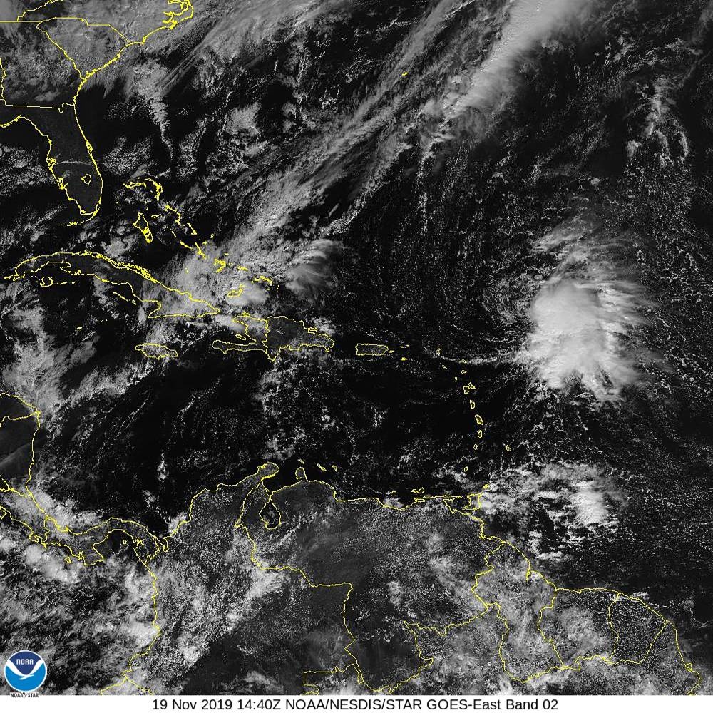
TROPICAL STORM CENTER LOCATED NEAR 20.1N 58.7W AT 19/1500Z
POSITION ACCURATE WITHIN 30 NM

PRESENT MOVEMENT TOWARD THE NORTH-NORTHWEST OR 330 DEGREES AT 7 KT

ESTIMATED MINIMUM CENTRAL PRESSURE 1008 MB
MAX SUSTAINED WINDS 40 KT WITH GUSTS TO 40 KT.
34 KT....... 90NE 0SE 0SW 0NW.
12 FT SEAS.. 90NE 0SE 0SW 0NW.
WINDS AND SEAS VARY GREATLY IN EACH QUADRANT. RADII IN NAUTICAL
MILES ARE THE LARGEST RADII EXPECTED ANYWHERE IN THAT QUADRANT.

REPEAT...CENTER LOCATED NEAR 20.1N 58.7W AT 19/1500Z
AT 19/1200Z CENTER WAS LOCATED NEAR 19.8N 58.5W

FORECAST VALID 20/0000Z 21.0N 59.2W
MAX WIND 40 KT...GUSTS 50 KT.
34 KT... 90NE 90SE 0SW 0NW.

FORECAST VALID 20/1200Z 22.2N 60.0W
MAX WIND 45 KT...GUSTS 55 KT.
34 KT... 90NE 130SE 0SW 0NW.

FORECAST VALID 21/0000Z 23.5N 60.0W
MAX WIND 45 KT...GUSTS 55 KT.
34 KT...100NE 140SE 0SW 0NW.

FORECAST VALID 21/1200Z 25.5N 58.3W...POST-TROP/EXTRATROP
MAX WIND 45 KT...GUSTS 55 KT.
34 KT...100NE 150SE 0SW 0NW.

FORECAST VALID 22/1200Z...DISSIPATED

REQUEST FOR 3 HOURLY SHIP REPORTS WITHIN 300 MILES OF 20.1N 58.7W

NEXT ADVISORY AT 19/2100Z

$$
FORECASTER LATTO


luismeteo3

Furacão
Registo
14 Dez 2015
Mensagens
17,112
Local
Fatima (320m)
b2bf65da1ebdaf65e24017e56ec89d6b0e2975250196317889f6c6d4e53a2052.jpg
 

luismeteo3

Furacão
Registo
14 Dez 2015
Mensagens
17,112
Local
Fatima (320m)
000
WTNT45 KNHC 191501
TCDAT5

Tropical Storm Sebastien Discussion Number 1
NWS National Hurricane Center Miami FL AL202019
1100 AM AST Tue Nov 19 2019

Satellite imagery indicates that the overall cloud pattern of the
disturbance has improved since yesterday, and that the low has
become well-defined. In addition, a late-arriving ASCAT-B
scatterometer pass showed 35-38 kt winds extending 90 n mi from the
center in the northeastern quadrant. This pass also revealed that
the low was nearly closed at the surface, and since the
scatterometer may not have resolved the small scale of the low-level
center it is likely that the surface low is indeed closed. Based on
these data, advisories are being initiated on Tropical Storm
Sebastian with an initial advisory intensity of 40 kt.

The depression will not be in an ideal environment for significant
intensification, as it will be battling dry air to its west and
about 20 kt of northwesterly shear for the next couple of days.
However, due to the presence of an upper trough to the west of the
system, a diffluent environment aloft may aid in some slight
strengthening over the next day or so. After that time, the
depression will begin to interact with an approaching cold front,
and some additional intensification may occur due to baroclinic
processes. The cyclone is then expected to become absorbed by the
front in about 48 hours. The various intensity guidance solutions
are in decent agreement, and the official forecast is near the mean
of these forecasts. There are some timing variations among the
models on when the cyclone will become absorbed by the front, and it
is possible that the depression could be absorbed sooner than
indicated.

The initial motion is 330/07 kt. The depression will be steered to
the northwest in the near term around a deep-layer ridge over the
central Atlantic. By Wednesday, the cyclone should turn north, and
then should accelerate northeastward by Wednesday night as the
cyclone gets caught up in the flow between the retreating ridge and
ahead of the approaching cold front. The model guidance is in good
agreement on this scenario, and on the official forecast track the
cyclone will remain over open waters for the duration of its
existence.

FORECAST POSITIONS AND MAX WINDS

INIT 19/1500Z 20.1N 58.7W 40 KT 45 MPH
12H 20/0000Z 21.0N 59.2W 40 KT 45 MPH
24H 20/1200Z 22.2N 60.0W 45 KT 50 MPH
36H 21/0000Z 23.5N 60.0W 45 KT 50 MPH
48H 21/1200Z 25.5N 58.3W 45 KT 50 MPH...POST-TROP/EXTRATROP
72H 22/1200Z...DISSIPATED

$$
Forecaster Latto
 

luismeteo3

Furacão
Registo
14 Dez 2015
Mensagens
17,112
Local
Fatima (320m)
000
WTNT35 KNHC 192034
TCPAT5

BULLETIN
Tropical Storm Sebastien Advisory Number 2
NWS National Hurricane Center Miami FL AL202019
500 PM AST Tue Nov 19 2019

...SEBASTIEN CONTINUES NORTHWESTWARD...
...EXPECTED TO TURN TO THE NORTHEAST LATE WEDNESDAY...

SUMMARY OF 500 PM AST...2100 UTC...INFORMATION
----------------------------------------------
LOCATION...20.6N 59.7W
ABOUT 275 MI...445 KM NE OF THE NORTHERN LEEWARD ISLANDS
MAXIMUM SUSTAINED WINDS...45 MPH...75 KM/H
PRESENT MOVEMENT...NW OR 305 DEGREES AT 12 MPH...19 KM/H
MINIMUM CENTRAL PRESSURE...1006 MB...29.71 INCHES

WATCHES AND WARNINGS
--------------------
There are no coastal watches or warnings in effect.

DISCUSSION AND OUTLOOK
----------------------
At 500 PM AST (2100 UTC), the center of Tropical Storm Sebastien was located near latitude 20.6 North, longitude 59.7 West. Sebastien is moving toward the northwest near 12 mph (19 km/h). A turn to the north is expected on Wednesday followed by a turn to the northeast with an increase in forward speed Wednesday night.

Maximum sustained winds are near 45 mph (75 km/h) with higher gusts. Some strengthening is forecast during the next 48 hours. Sebastien is expected to become an extratropical cyclone in a couple of days and will then be absorbed by a cold front late this week.

Tropical-storm-force winds extend outward up to 105 miles (165 km) from the center.

The estimated minimum central pressure is 1006 mb (29.71 inches).

HAZARDS AFFECTING LAND
----------------------
None

NEXT ADVISORY
-------------
Next complete advisory at 1100 PM AST.

$$
Forecaster Latto
 
  • Gosto
Reactions: Wessel1985

luismeteo3

Furacão
Registo
14 Dez 2015
Mensagens
17,112
Local
Fatima (320m)
000
WTNT45 KNHC 192035
TCDAT5

Tropical Storm Sebastien Discussion Number 2
NWS National Hurricane Center Miami FL AL202019
500 PM AST Tue Nov 19 2019

The low-level center of Sebastien has been exposed over the past several hours, as northwesterly shear of 20-30 kt has been pushing any deep convection off to the southeastern portion of the cyclone. The initial advisory intensity is being held at 40 kt and is based on an earlier scatterometer pass that sampled maximum winds of 39 kt.

The initial motion is 305/10 kt. Sebastien is forecast to be steered to the northwest around a deep-layer ridge over the central Atlantic through tonight. By Wednesday, the cyclone should turn to the north, and then accelerate northeastward Wednesday night as the cyclone gets caught up in the flow between the retreating ridge and ahead of an approaching cold front. The model guidance remains in good agreement on this scenario, and the official forecast track keeps the cyclone over open waters for the duration of its existence.

The shear is not expected to decrease much over the next couple days while the system remains a tropical cyclone. There may be an opportunity for some strengthening Wednesday and Wednesday night as Sebastien turns to the north and northeast and resides under some favorable upper-level diffluence. By 48 hours, Sebastien is expected to transition to an extratropical cyclone just ahead of an approaching cold front. Therefore, additional strengthening indicated beyond 36 hours should be due to baroclinic processes. The cyclone should then become absorbed by the cold front by late this week. The official forecast was adjusted slightly higher from the previous one at 36 and 48 hours to reflect the anticipated intensification of the system as it begins its extratropical transition.

FORECAST POSITIONS AND MAX WINDS

INIT 19/2100Z 20.6N 59.7W 40 KT 45 MPH
12H 20/0600Z 21.3N 60.7W 40 KT 45 MPH
24H 20/1800Z 22.6N 61.9W 45 KT 50 MPH
36H 21/0600Z 24.2N 61.0W 50 KT 60 MPH
48H 21/1800Z 26.0N 58.9W 55 KT 65 MPH...POST-TROP/EXTRATROP
72H 22/1800Z...DISSIPATED

$$
Forecaster Latto
 

luismeteo3

Furacão
Registo
14 Dez 2015
Mensagens
17,112
Local
Fatima (320m)
...SEBASTIEN EXPECTED TO BECOME A HURRICANE BY TONIGHT...
11:00 AM AST Thu Nov 21
Location: 23.5°N 60.5°W
Moving: NNE at 8 mph
Min pressure: 999 mb
Max sustained: 60 mph


000
WTNT45 KNHC 211449
TCDAT5

Tropical Storm Sebastien Discussion Number 9
NWS National Hurricane Center Miami FL AL202019
1100 AM AST Thu Nov 21 2019

Sebastien continues to produce a large area of deep convection over
the eastern semicircle of the circulation, but the banding features
are not very well defined. The intensity estimate remains at 50 kt
based on a blend of subjective Dvorak estimates from TAFB and SAB.
A diffluent upper-level wind environment and warm waters are
expected to bring about some strengthening through tonight, however
the window of opportunity for strengthening will probably close
tomorrow morning. After that time, drier air and strong shear
should cause gradual weakening. The official intensity forecast is
a little above the model consensus. In a couple of days, the
GFS shows Sebastien becoming embedded in a frontal zone, signifying
the transition to an extratropical cyclone as shown in the NHC
forecast. The ECMWF model suggests that this event could occur
later, but the current close proximity of a front to Sebastian
argues for extratropical transition to occur within 48 hours.

The circulation is a bit elongated from south to north, and the
center remains difficult to locate. This results in a greater than
normal uncertainty in the initial motion, and my best guess is 030/7
kt. A turn toward the northeast, with acceleration, is expected
during the next couple of days due to the influence of a mid-level
trough. There is considerable along-track model spread, with the
ECMWF forecast being much slower than the majority of the guidance.
The official forecast is somewhat slower than the dynamical model
consensus out of respect for that typically reliable model.

FORECAST POSITIONS AND MAX WINDS

INIT 21/1500Z 23.5N 60.5W 50 KT 60 MPH
12H 22/0000Z 25.0N 58.3W 65 KT 75 MPH
24H 22/1200Z 27.2N 55.0W 70 KT 80 MPH
36H 23/0000Z 30.0N 50.4W 65 KT 75 MPH
48H 23/1200Z 33.2N 45.2W 55 KT 65 MPH...POST-TROP/EXTRATROP
72H 24/1200Z 39.7N 31.5W 35 KT 40 MPH...POST-TROP/EXTRATROP
96H 25/1200Z...DISSIPATED

$$
Forecaster Pasch