Tropical Cyclone Advisory #8 - 22:00 PM RET December 5 2019
CYCLONE TROPICAL INTENSE AMBALI (03-20192020)
=========================================
East Northeast of Agalega
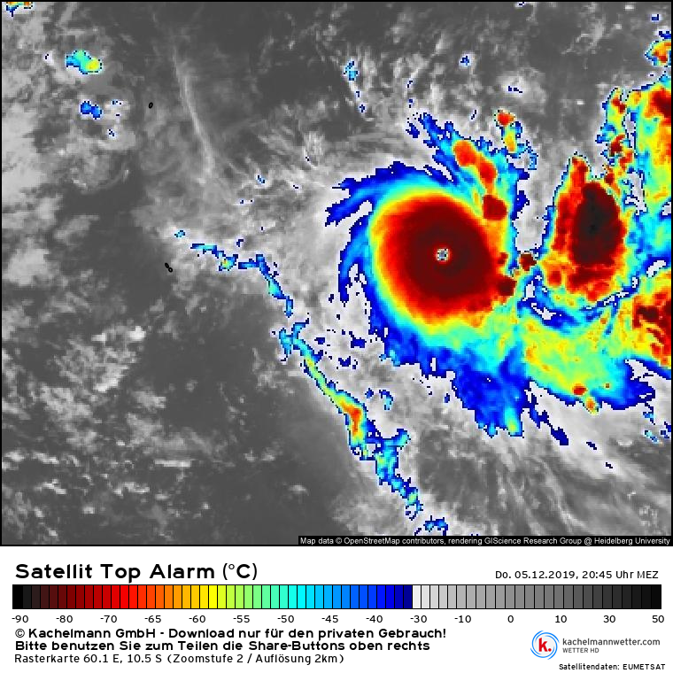
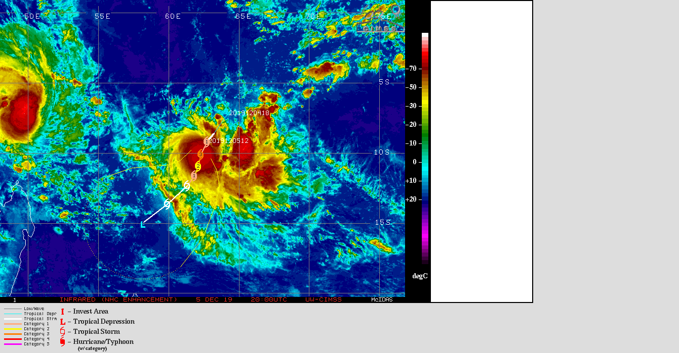
At 18:00 PM UTC, Intense Tropical Cyclone Ambali (962 hPa) located at 10.0S 62.5E has 10 minute sustained winds of 90 knots with gusts of 125 knots. The cyclone is reported as moving south southwest at 11 knots
Hurricane Force Winds
=====================
15 nm radius from the centre, extending up to 20 nm in the southeastern quadrant
Storm Force Winds
===================
25 nm radius from the centre, extending up to 30 nm in the southeastern quadrant
Gale Force Winds
============
35 nm radius from the centre, extending up to 50 nm in the southeastern quadrant
Near Gale Force Winds
================
40 nm radius from the centre, extending up to 50 nm in the southwestern quadrant and up to 60 nm in the southeastern quadrant
Dvorak Intensity: T5.5/5.5/D2.0/6 HRS
Forecast and Intensity
========================
12 HRS 11.3S 62.1E - 100 knots (Cyclone Tropical Intense)
24 HRS 12.2S 62.0E - 80 knots (Cyclone Tropical)
48 HRS 13.1S 61.3E - 40 knots (Tempête Tropicale Modérée)
72 HRS 14.4S 59.9E - 25 knots (Depression se Comblant)
Additional Information
=================
During the last 6 hours, the system has undergone an explosive intensification. Eye is surrounding by a ring of very cold top clouds while the eye is warming. Considering that the system is very compact, the dvorak constraint rules have been broken.
Little change in terms of track forecast for short times: a low and mid_level ridge centred on the eastern half of the basin steers the system generally south southwestwards. From Saturday, when the system is expected to weaken significantly, the directional flow should come back down to the low levels inducing a more southwestern track than initially expected : the residual minimum should thus drift southwest and continue to fill until monday.
Ambali continues to benefits from good environmental conditions : in the upper levels, divergence remains good and vertical windshear is low. Ocean heat content is particularly high over this area of the basin. The intensification could continue this night. But, from tomorrow and beyond, due to an approaching upper levels trough, a westerly shear constraint appears in the mid-levels, then in the upper levels quickly after, associated with mid-levels dry air intrusion. A rather rapid weakening is suggested by the available intensity guidance. The intensity forecast for such a small system remains challenging and associated with a greater than usual uncertainty.