Ciclone Tropical DEZASSEIS (Atlântico 2019 #AL16)
- Thread starter luismeteo3
- Data de início
-
O novo portal está no ar! Novos meteogramas, cartas, e mais. Mais informações neste tópico
Seguimento Meteorológico: Litoral Norte | Interior Norte e Centro | Litoral Centro | Sul | Açores e Madeira | Livre
Previsões: Curto e médio prazo: até 2 semanas | Longo prazo: mensal e sazonal (Regras e links úteis nos 1ºs posts)
Facebook | Avisos IPMA/Alertas ANEPC
You are using an out of date browser. It may not display this or other websites correctly.
You should upgrade or use an alternative browser.
You should upgrade or use an alternative browser.

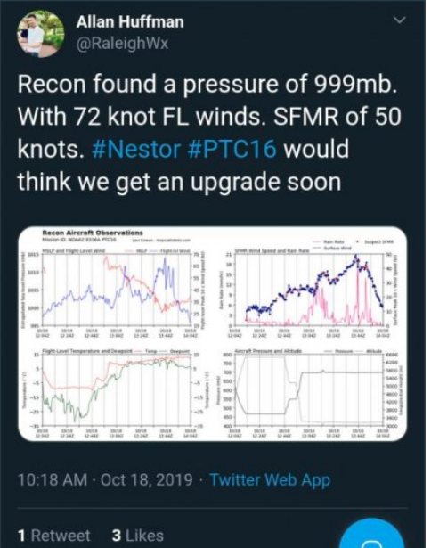
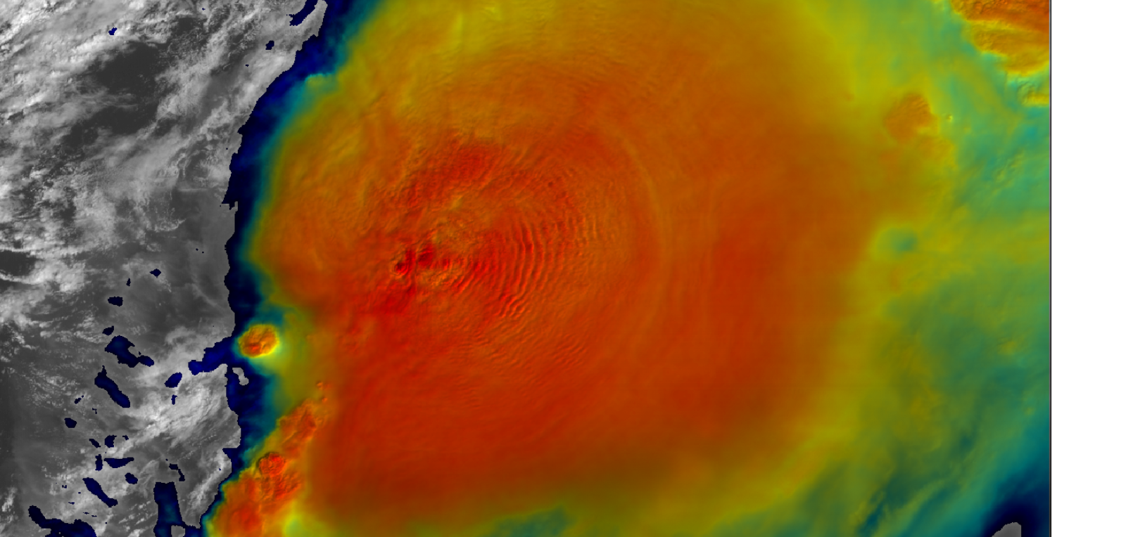

Tempestade tropical Nestor agora...
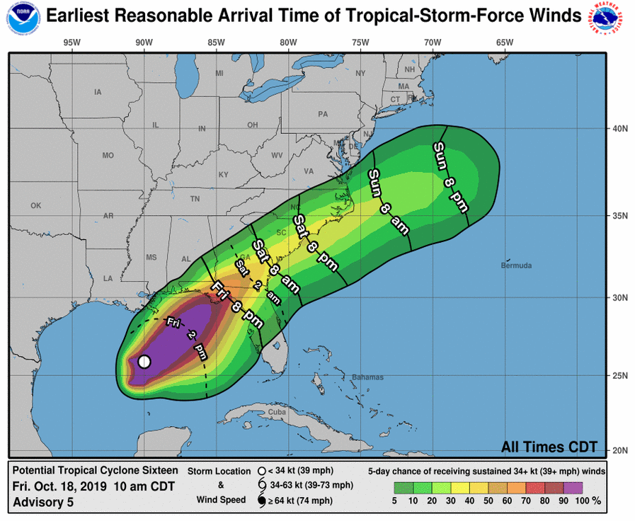
...DISTURBANCE BECOMES TROPICAL STORM NESTOR... ...DANGEROUS STORM SURGE AND TROPICAL STORM FORCE WINDS EXPECTED ALONG PORTIONS OF THE NORTHERN GULF COAST LATER TODAY AND TONIGHT...
1:00 PM CDT Fri Oct 18
Location: 26.3°N 89.5°W
Moving: NE at 22 mph
Min pressure: 1001 mb
Max sustained: 60 mph
...DISTURBANCE BECOMES TROPICAL STORM NESTOR... ...DANGEROUS STORM SURGE AND TROPICAL STORM FORCE WINDS EXPECTED ALONG PORTIONS OF THE NORTHERN GULF COAST LATER TODAY AND TONIGHT...
1:00 PM CDT Fri Oct 18
Location: 26.3°N 89.5°W
Moving: NE at 22 mph
Min pressure: 1001 mb
Max sustained: 60 mph
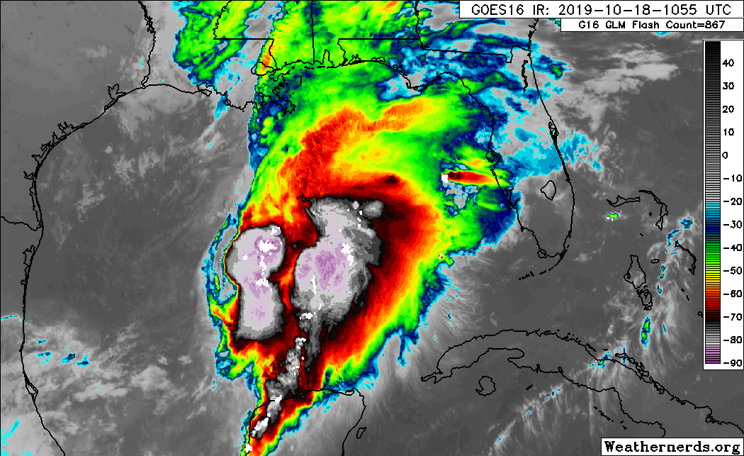
Satellite imagery and ship and buoy data indicate that the
circulation of the low pressure system has become better defined,
and the disturbance is now Tropical Storm Nestor.
At 100 PM CDT (1800 UTC), the center of Tropical Storm Nestor was
located near latitude 26.3 North, longitude 89.5 West. Nestor is
moving toward the northeast near 22 mph (35 km/h), and this general
motion is expected to continue through Sunday, followed by a turn
toward the east-northeast by early Monday. On the forecast track,
the center of Nestor will approach the northern Gulf Coast later
today and tonight and move inland across portions of the
southeastern United States Saturday and Sunday as it becomes a
post-tropical cyclone. Nestor is expected to move offshore of the
coast of North Carolina into the western Atlantic by late Sunday.
Maximum sustained winds are near 60 mph (95 km/h) with higher
gusts. Some strengthening is expected later today, with weakening
forecast after Nestor moves inland. Nestor is expected to lose
tropical characteristics and become post-tropical on Saturday.
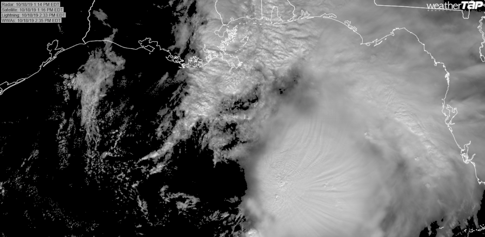
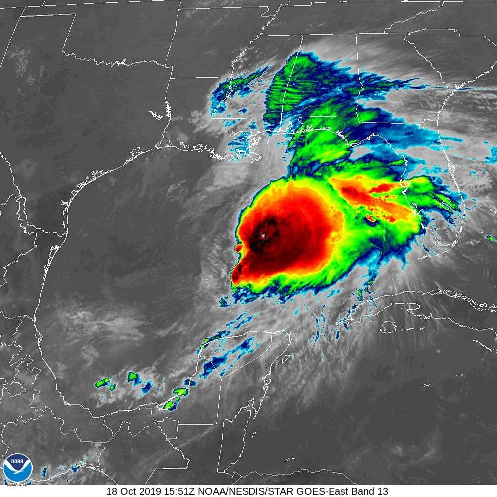
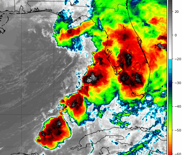
...WINDS AND STORM SURGE SHOULD BE AFFECTING MUCH OF THE GULF COAST
OF FLORIDA...
...NESTOR GRADUALLY LOSING ITS TROPICAL CHARACTERISTICS...
4:00 AM CDT Sat Oct 19
Location: 29.0°N 86.0°W
Moving: NE at 17 mph
Min pressure: 998 mb
Max sustained: 50 mph
OF FLORIDA...
...NESTOR GRADUALLY LOSING ITS TROPICAL CHARACTERISTICS...
4:00 AM CDT Sat Oct 19
Location: 29.0°N 86.0°W
Moving: NE at 17 mph
Min pressure: 998 mb
Max sustained: 50 mph
Partilhar: