Felipe Freitas
Cumulonimbus
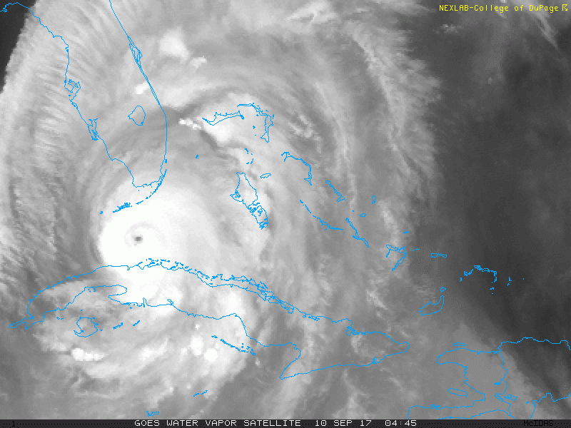
Olho pinhole no momento, o ciclo de substituição da parede do olho deve ser finalizado nas próximas horas.
Por ser um furacão muito grande, os ventos demoram para responder a queda de pressão.
Até o momento dois tornados reportados na Flórida.

Por ser um furacão muito grande, os ventos demoram para responder a queda de pressão.
Até o momento dois tornados reportados na Flórida.