Previsão e Seguimento Furacões (Pacífico Leste e Central 2018)
- Thread starter luismeteo3
- Data de início
-
O novo portal está no ar! Novos meteogramas, cartas, e mais. Mais informações neste tópico
Seguimento Meteorológico: Litoral Norte | Interior Norte e Centro | Litoral Centro | Sul | Açores e Madeira | Livre
Previsões: Curto e médio prazo: até 2 semanas | Longo prazo: mensal e sazonal (Regras e links úteis nos 1ºs posts)
Facebook | Avisos IPMA/Alertas ANEPC
You are using an out of date browser. It may not display this or other websites correctly.
You should upgrade or use an alternative browser.
You should upgrade or use an alternative browser.


Excerpt from the Hurricane Watch on the South Big Island. Rainfall poses the highest threat.
Flooding rain
LATEST LOCAL FORECAST: Flash Flood Watch is in effect
Peak Rainfall Amounts: Additional More than two feet
POTENTIAL THREAT TO LIFE AND PROPERTY: Potential for extreme flooding rain
PLAN: Emergency plans should include the potential for extreme flooding from heavy rain. Evacuations and rescues are likely.
PREPARE: Urgently consider protective actions from extreme and widespread rainfall flooding.
ACT: Heed any flood watches and warnings. Failure to take action will likely result in serious injury or loss of life.
POTENTIAL IMPACTS: Devastating to Catastrophic
Extreme rainfall flooding may prompt numerous evacuations and rescues.
Rivers and tributaries may overwhelmingly overflow their banks in many places with deep moving water. Small streams, creeks, canals, arroyos, and ditches may become raging rivers. In mountain areas, deadly runoff may rage down valleys while increasing susceptibility to rockslides and mudslides. Flood control systems and barriers may become stressed.
Flood waters can enter numerous structures within multiple communities, some structures becoming uninhabitable or washed away. Numerous places where flood waters may cover escape routes. Streets and parking lots become rivers of raging water with underpasses submerged. Driving conditions become very dangerous. Numerous road and bridge closures with some weakened or washed out.
(http://www.prh.noaa.gov/hnl... )
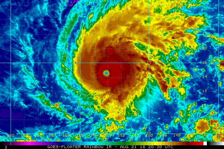
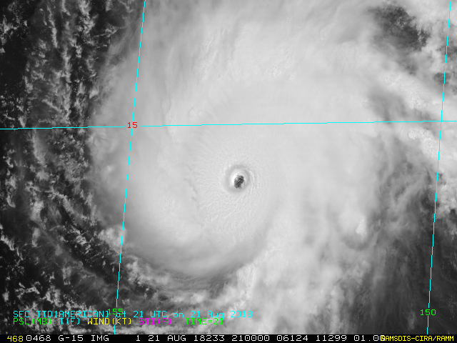
136 knotsO furacão Lane acaba de atingir a categoria 5! 934Mb, 137kts at surface
(~ 156.5 mph)
931.5 mb
(~ 27.51 inHg)