Japan Meteorological Agency
Tropical Cyclone Advisory #27 - 3:00 AM JST July 21 2018
SEVERE TROPICAL STORM AMPIL (T1810)
===========================================================
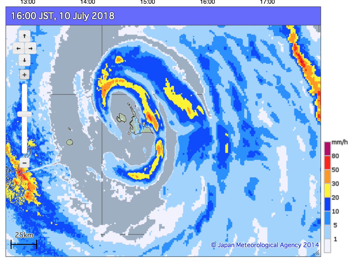
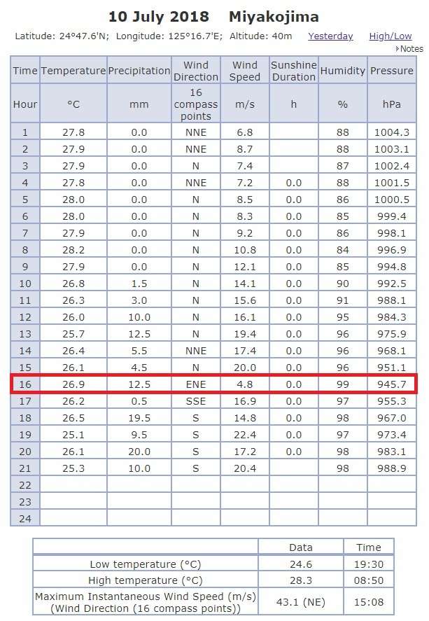
130 km east southeast of Naha (Okinawa Prefecture)
At 18:00 PM UTC, Severe Tropical Storm Ampil (985 hPa) located at 25.6N 129.0E has 10 minute sustained winds of 50 knots with gusts of 70 knots. The cyclone is reported as moving north northwest at 14 knots.
Gale Force Winds
================
270 NM from the center in northeastern quadrant
180 NM from the center in southwestern quadrant
Dvorak Intensity: T3.0
Forecast and Intensity
======================
24 HRS: 29.7N 123.5E - 55 knots (CAT 2/Severe Tropical Storm) East China Sea
48 HRS: 32.6N 118.8E - 35 knots (CAT 1/Tropical Storm) Over land Central China
72 HRS: 35.2N 115.6E - Tropical Depression Over land Northern China
-------------------------------------
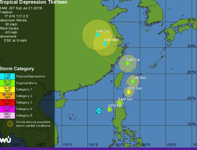
Tropical Disturbance Summary
TROPICAL DEPRESSION 1000 HPA AT 18N 117E ESE SLOWLY.