Mário Barros
Furacão
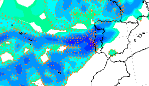
Por aqui tambem já chove e está com tendencia a intenseficar-se  estou com 9.1ºC.
Já lá vai 1 mm...hehe já igualei o mês de Outubro.
estou com 9.1ºC.Já lá vai 1 mm...hehe já igualei o mês de Outubro.
estou com 9.1ºC. :rolleyes:")
 em 3 mm estou com 9.9ºC.
 . Mas uma coisa é certa, os valores de Outubro já devem ter sido superados .
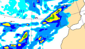
 , que venha a chuva em bastante quantidade


