India Meteorological Department
Tropical Cyclone Advisory #38 - 8:30 AM IST October 29 2019
EXTREMELY SEVERE CYCLONIC STORM KYARR (ARB03-2019)
=========================================
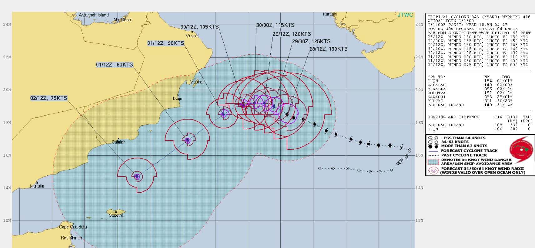
At 3:00 AM UTC, The super cyclonic storm ‘Kyarr’ moved west northwestwards with a speed of 9 km/h during past 6 hours, weakened into an extremely severe cyclonic storm over west central and adjoining east central & northern Arabian Sea and lays centered near 19.2N 63.4E, about 990 km west of Mumbai (Maharashtra), 1010 km east northeast of Salalah (Oman) and 500 km east southeast of Masirah (Oman).
It is very likely to move west northwestwards until morning of October 30th, re-curve west southwestwards thereafter and move towards Gulf of Aden off southern Oman-Yemen coasts during subsequent 3 days. It is very likely to weaken into a very severe cyclonic storm during the morning of 30th October and further into a severe cyclonic Storm by the evening of October 31st.
Satellite images indicate eye pattern with ragged eye in ir imagery. Present eye temperature is minus 34.6C. As per the satellite imagery, the current intensity of the system is T5.5/6.5. Associated broken low to medium clouds with embedded intense to very intense convection lies over west central and adjoining east central Arabian sea between lat 17.5N to 21.5N and long 61.5E to 65.5E. The minimum cloud top temperature is -93C.
3 minute sustained winds near the center is 115 knots with gusts of 130 knots. The state of the sea is phenonemal around the center. Estimated central pressure of the extremely severe cyclonic storm is 943 hPa.