Key Messages:
1. Lorenzo is a large hurricane, and its hurricane- and
tropical-storm-force wind fields are expected to expand further
during the next several days. Regardless of Lorenzo's exact track
near the Azores, strong winds are becoming increasingly likely on
the islands Tuesday night and Wednesday, and residents there should
monitor the progress of the hurricane.
2. Large swells generated by Lorenzo will continue to spread across
much of the western and northern parts of the Atlantic basin during
the next few days. These swells will produce life-threatening surf
and rip currents.
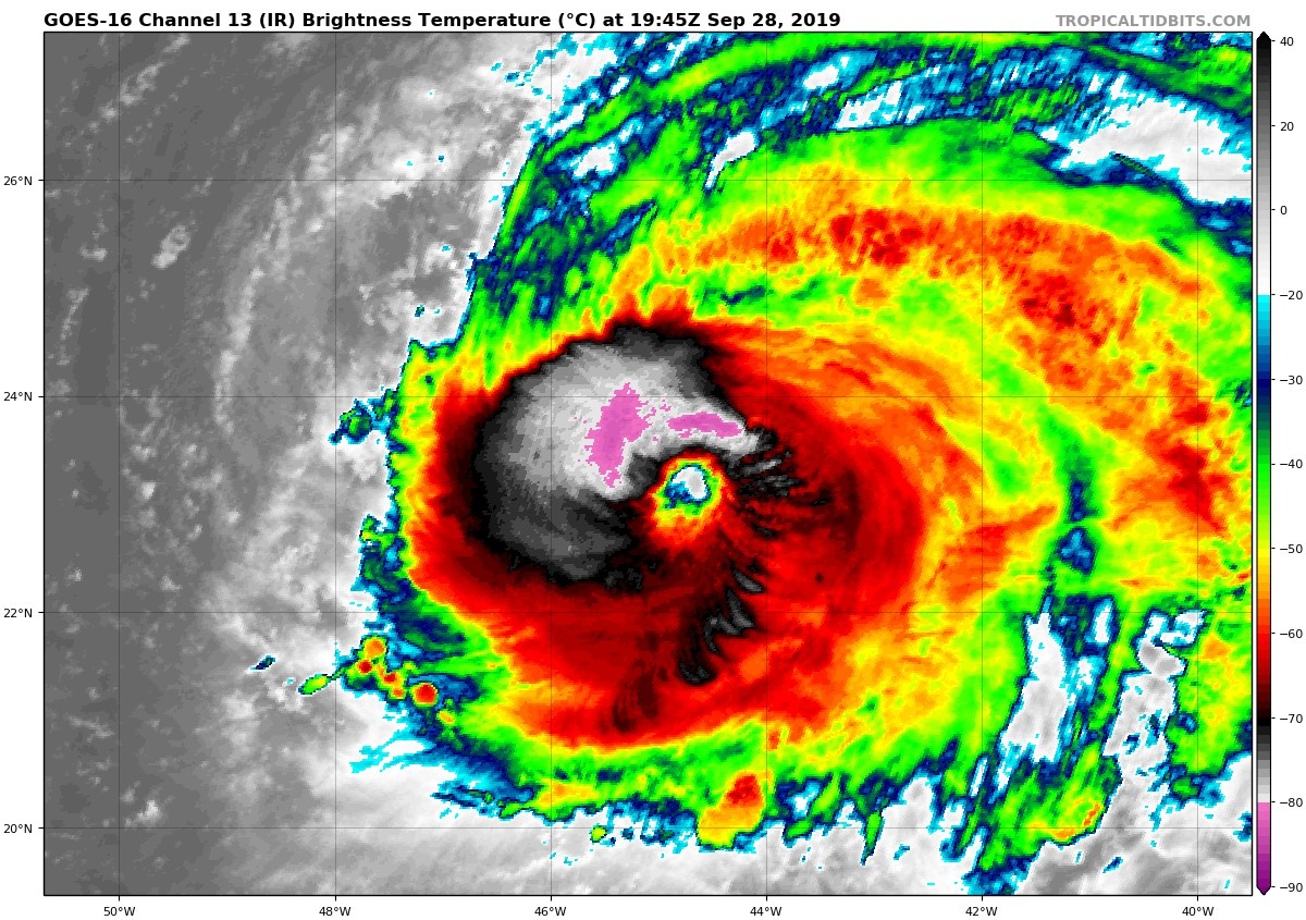
FORECAST POSITIONS AND MAX WINDS
INIT 28/2100Z 23.3N 45.0W 115 KT 130 MPH
12H 29/0600Z 24.6N 44.8W 110 KT 125 MPH
24H 29/1800Z 26.3N 44.3W 105 KT 120 MPH
36H 30/0600Z 28.0N 43.7W 100 KT 115 MPH
48H 30/1800Z 29.7N 42.9W 95 KT 110 MPH
72H 01/1800Z 34.8N 38.0W 90 KT 105 MPH
96H 02/1800Z 42.5N 26.5W 75 KT 85 MPH
120H 03/1800Z 49.0N 13.0W 60 KT 70 MPH...POST-TROP/EXTRATROP