Previsão e Seguimento Furacões (Pacífico Leste e Central 2018)
- Thread starter luismeteo3
- Data de início
-
O novo portal está no ar! Novos meteogramas, cartas, e mais. Mais informações neste tópico
Seguimento Meteorológico: Litoral Norte | Interior Norte e Centro | Litoral Centro | Sul | Açores e Madeira | Livre
Previsões: Curto e médio prazo: até 2 semanas | Longo prazo: mensal e sazonal (Regras e links úteis nos 1ºs posts)
Facebook | Avisos IPMA/Alertas ANEPC
You are using an out of date browser. It may not display this or other websites correctly.
You should upgrade or use an alternative browser.
You should upgrade or use an alternative browser.
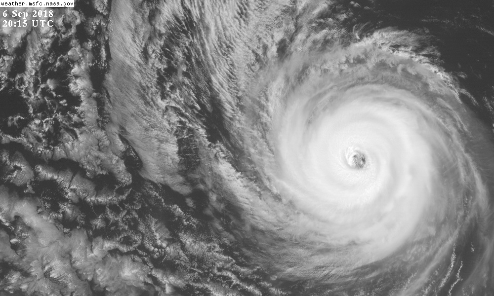
Lane é resiliência em "pessoa"

Atualmente como TT, mas irá inevitavelmente para Norte e dissipará rapido, de vez.

(nhc)
226
WTPZ31 KNHC 301230
TCPEP1
BULLETIN
Hurricane Norman Special Advisory Number 9
NWS National Hurricane Center Miami FL EP162018
530 AM PDT Thu Aug 30 2018
...NORMAN CONTINUES TO RAPIDLY STRENGTHEN...
SUMMARY OF 530 AM PDT...1230 UTC...INFORMATION
----------------------------------------------
LOCATION...17.8N 117.7W
ABOUT 615 MI...990 KM WSW OF THE SOUTHERN TIP OF BAJA CALIFORNIA
MAXIMUM SUSTAINED WINDS...145 MPH...230 KM/H
PRESENT MOVEMENT...W OR 275 DEGREES AT 8 MPH...13 KM/H
MINIMUM CENTRAL PRESSURE...942 MB...27.82 INCHES

Norman has rapidly strengthened during the past 12 to 24 hours,
with the development of a well-defined 20-nmi-wide eye and a thick
ring of cold cloud tops of -70 to -85C. Dvorak constraints have
limited the amount of increase in the subjective and objective final
T-numbers, but the most recent raw data T-numbers are between T6.5
and T7.2, which yields an initial intensity estimate of 130 kt.
Norman's intensity has increased an estimated 70 kt from 1200 UTC
yesterday morning to 1200 UTC this morning- the fastest in the
basin since Patricia in 2015. Norman has become the 5th category 4
hurricane in the eastern Pacific in 2018 and is also the strongest
hurricane in the basin so far this season.
973
WTPZ31 KNHC 021437
TCPEP1
BULLETIN
Hurricane Norman Advisory Number 22
NWS National Hurricane Center Miami FL EP162018
800 AM PDT Sun Sep 02 2018
...NORMAN HAS MADE A REMARKABLE COME BACK AND BECOMES A CATEGORY
FOUR HURRICANE AGAIN...
SUMMARY OF 800 AM PDT...1500 UTC...INFORMATION
----------------------------------------------
LOCATION...17.6N 129.1W
ABOUT 1295 MI...2085 KM WSW OF THE SOUTHERN TIP OF BAJA CALIFORNIA
MAXIMUM SUSTAINED WINDS...130 MPH...215 KM/H
PRESENT MOVEMENT...WNW OR 285 DEGREES AT 18 MPH...30 KM/H
MINIMUM CENTRAL PRESSURE...948 MB...28.00 INCHES
...OLIVIA BECOMES A MAJOR HURRICANE...
2:00 PM PDT Tue Sep 4
Location: 16.9°N 119.2°W
Moving: W at 12 mph
Min pressure: 959 mb
Max sustained: 120 mph

2:00 PM PDT Tue Sep 4
Location: 16.9°N 119.2°W
Moving: W at 12 mph
Min pressure: 959 mb
Max sustained: 120 mph


